
Groundwater Modelling in The Andes: Balancing Industry and Environment

November 20, 2012
The abundance of copper and gold found in the high altitudes of the Andes Mountains makes this mountain range a desirable, yet challenging region to mine. As mining operations require a profusion of water for processing activities, dewatering and monitoring wells must be installed to provide the necessary access to water resources. Care must be taken to ensure a minimal impact on the natural groundwater flow and conditions, as well as the natural environment as a whole. A strong understanding of the geologic and hydro-geologic conditions of the area is essential to forecasting the short and long term effects of the mining project on groundwater resources.
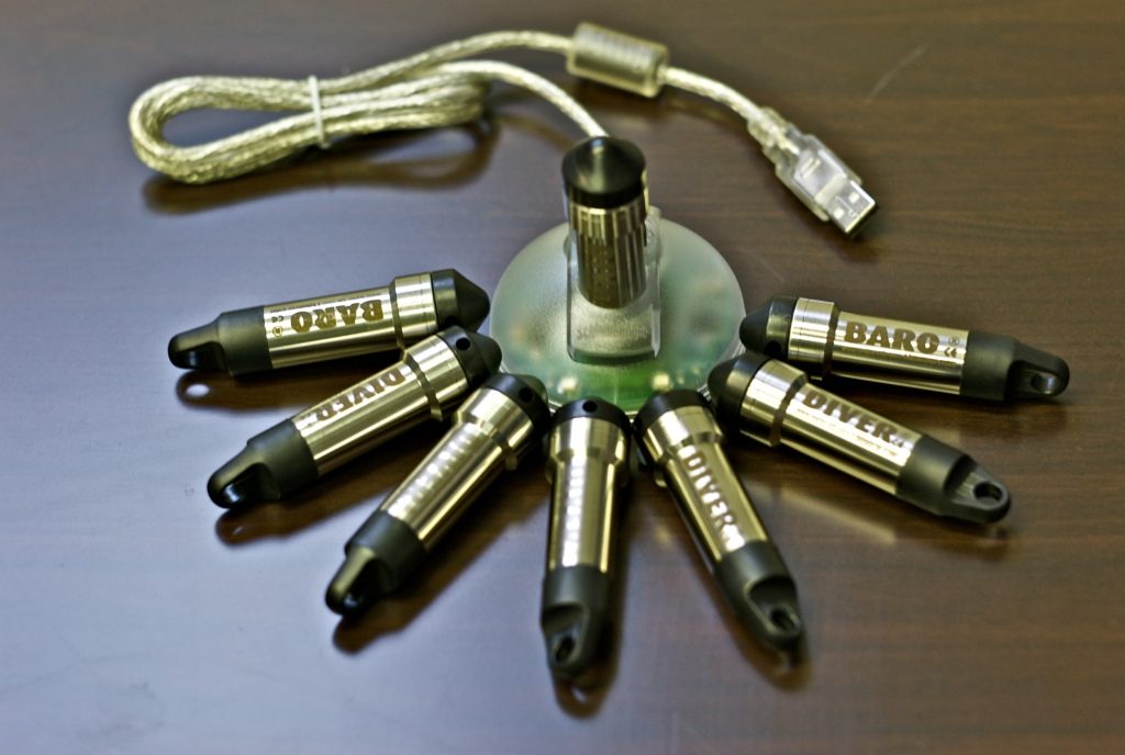
This article outlines the use of Visual MODFOW Flex and Diver water level loggers in pre-mining forecasting and groundwater monitoring in operating mines in the Andes mountain range.
The understanding of the groundwater flow system calls for the use of surface geophysical techniques alongside monitoring wells to gather data and develop a numerical model. Specifically, it involves estimating the surface water and groundwater flow components into and out of a basin, and the uncertainty with each component. Visual MODFLOW has been used in the Andes to develop regional-scale models to investigate the impact of mines on the natural environment.
Developing a Baseline Groundwater Model
A pre-mine (baseline) groundwater model is used to define conditions before the mine is constructed. A successful model must first determine an accurate water balance for the area being studied, but in modelling projects of the Andes mountain range, water calibration is a major issue. The groundwater elevation data tends to be scarce in this region because of the remote location and the desert-like climate. In order to offset the uncertainty in the water balance components, Diver water level loggers collect time varying data to collect a better calibration data set. More data provides a better estimate of model parameters for Visual MODFLOW Flex– which creates greater confidence in the models created. Divers are also used to determine the hydraulic conductivity at locations through-out the site, and to monitor slope stability.
Simulating Mine Pit Dewatering
Mine pit dewatering models are then used to show the impact of mining on the water table and groundwater discharge to surrounding rivers, wetlands, etc. Mines in the Andes need more water than is available from simply dewatering the open pit, thus they must use extraction well fields at higher altitudes. At these altitudes alluvial valley aquifers contain vast amount of water in storage, however due to the climate the replenishing rate of the aquifer system can be as low as 1-20mm per year. Another result of the low recharge to the aquifer is that drawdown propagates for extended periods beyond the cessation of pumping. Also, the evaporation rate in the region greatly exceeds the annual precipitation having been measured at 1200-2400mm per year.
Optimising Well Field Design to Minimise Environmental Impacts
The effects of the dry conditions can also be observed in the form of salars, large salt-water bodies formed by strong evaporation throughout the high Andes. Changes in groundwater discharge of mines impact the salt content of the salars, which are an extremely important eco-system as birds and other wildlife reside in these regions of the range. 3D numerical models can be used to identify optimal well field designs that make the mine a viable operation with little impact on the nearby wetland area. More specifically, Visual MODFLOW can be used to simulate the groundwater extraction and forecast its impacts on the salars and wetlands – using water level loggers to monitor de-watering will provide stronger data for modelling purposes.
Contaminant Transport Modelling with MT3D
A final use of Visual MODFLOW on mining sites in the Andes is forecasting the environmental impacts from contamination due to the waste rock pile or tailings storage facility. This is contaminant transport modelling with MT3D is used to show the direction, and concentration of the groundwater plume that develops beneath the tailing pond. This includes groundwater remediation design – modelling a groundwater extraction system to capture contaminants coming from the tailing facility.
SWS Technology for Mining Operations
Our partner, Schlumberger Water Services has developed an array of tools that when used in tandem can provide accurate modelling and confident forecasting for mining operations, in even the most remote of locations. Great efforts have been put forth to further facilitate groundwater monitoring of regions with limited accessibility. For example, Diver NETZ is a wireless system that collects data from groundwater monitoring networks, making that data accessible from the office or smart phone. Such technologies being used alongside a new generation of Visual MODFLOW software brings environmental modelling to an entirely new level.
Robin Albrecht
Regional Account Manager (Software) – Asia/Australia/New Zealand
You might also be interested in...
Van Walt Guidelines for sampling for PFAS in Groundwater
November 13, 2024We need to make clear, that at the time of writing, there are no ISO or EN standards which deal with the sampling of groundwater for PFAS.
Read MoreSpot measurement v. continuous environmental monitoring
August 25, 2023Environmental monitoring has developed considerably over the years. From the time when a consultant went out monthly or quarterly with a dip tape to monitor the groundwater level in a borehole, wind forward...
Read MoreMeasuring Nitrates (NO3, NO3-N) in the field
June 20, 2023The interest in Nitrates is nothing new. One way or another we have been measuring them for half a century.
Read MoreVan Walt Environmental Equipment
A small selection of our environmental equipment